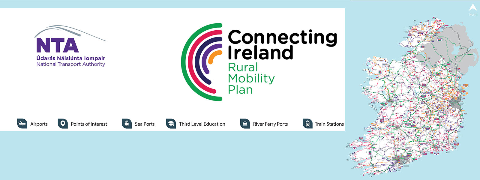
Connecting Ireland Proposed Transport Network Update – February 2026
The Connecting Ireland Transport Network map (February 2026) is a representation of the current and future public transport network for rural Ireland.
This map
- The original version of this map was published in December 2021 has been developed over the last 4 years.
- This map has evolved to take into account feedback from Transport Coordination Units (TFI Local Link), Bus Éireann, public representatives, member of the public and other stakeholders.
- This map is continually changing in response to discussions and service planning work, taking into account the principles set out in the Connecting Ireland Rural Mobility Plan.
The Connecting Ireland team at the NTA is working with TFI Local Link, Bus Éireann and other operators to finalise the proposed service levels on each future new or enhanced route. The details of this are not available yet for publication.
Key route categories
The map identifies 6 different route categories. See key below.
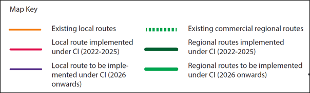
Existing Local Routes
No significant changes are planned to these routes. As the public transport network develops, and as more people travel more often and more widely by public transport, we will continue to review their usage and take steps to ensure their continued fitness-for-purpose.
Local route implemented under Connecting Ireland (2022-2025)
![]() Local routes connect smaller towns and villages and their rural catchments with nearby larger towns. This will improve access to the range of services available in larger centres, at more useful times of the day and week, for those living in rural areas and smaller villages. It will also permit transfer to regional services to travel onwards, with timed reliable connections. These local routes have been introduced or enhanced during the 2022 – 2025 period.
Local routes connect smaller towns and villages and their rural catchments with nearby larger towns. This will improve access to the range of services available in larger centres, at more useful times of the day and week, for those living in rural areas and smaller villages. It will also permit transfer to regional services to travel onwards, with timed reliable connections. These local routes have been introduced or enhanced during the 2022 – 2025 period.
Local route to be implemented under Connecting Ireland (2026 onwards)
Local routes connect smaller towns and villages and their rural catchments with nearby larger towns. This will improve access to the range of services available in larger centres, at more useful times of the day and week, for those living in rural areas and smaller villages. It will also permit transfer to regional services to travel onwards, with timed reliable connections. These local routes are planned to be introduced or enhanced from 2026 onwards.
Existing commercial regional routes
Existing commercial regional routes generally operate along main roads, connecting cities and large towns and any settlements enroute. We will work to with existing service providers to enhance their services consistent with objectives of Connecting Ireland Rural Mobility Plan.
Regional routes implemented under Connecting Ireland (2022- 2025)
Regional routes generally operate along main roads, connecting cities and large towns and any settlements enroute. These are mainly public bus services funded by the National Transport Authority. This category of service has already been implemented under the Connecting Ireland programme.
Regional Routes to be Implemented Under Connecting Ireland (2026 onwards)
Regional routes generally operate along main roads, connecting cities and large towns and any settlements enroute. These are mainly public bus services funded by the National Transport Authority. This category of new or enhanced service is planned to be implemented under the Connecting Ireland programme from 2026 onwards.