- new Core Bus Network
- Luas to Poolbeg / Finglas / Lucan
- Metro South – from St Stephens Green to Brides Glen
- Rail-based Park and Ride facilities
- expand cycling network to 1,485 km
Public consultation: October 15th – November 13th
Click here to access all consultation documents and the response channels
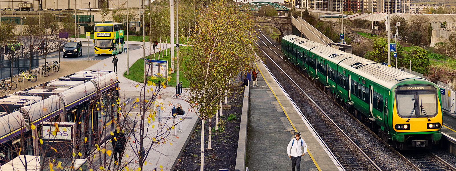
The National Transport Authority has released details of its new draft Transport Strategy for the Greater Dublin Area 2016-2035, setting out a cohesive and integrated transport framework to support and sustain the region’s development.
The draft strategy is subject to a statutory public consultation; members of the public and all interested parties are invited to review the proposals, and the supporting documentation, on the Authority’s website (www.nationaltransport.ie) and to make submissions to the Authority, until the deadline of 5:00pm on Friday November 13th 2015.
Anne Graham, CEO of the National Transport Authority said: “The purpose of our draft transport strategy is to contribute to the economic, social and cultural progress of the Greater Dublin Area by providing for the efficient, effective and sustainable movement of people and goods. The long-term success of the country’s capital region depends on sound and considered long-term strategic planning. We are therefore encouraging as many people as possible to read our proposals, and the background documentation, and to let us know their views by taking part in our consultation, before November 13th.”
The Authority is statutorily obliged (under section 12 of the Dublin Transport Authority Act 2008) to prepare a strategic transport plan, considering the future development of the transport system in the Greater Dublin Area (GDA) for a period of not less than 12 years and not more than 20 years, to provide a long-term strategic planning framework for the integrated development of transport infrastructure and services in the GDA.
The key proposals set out in the strategy include:
Bus:
- Proposes a “Core Bus Network” for the region comprising:
- 16 radial bus corridors;
- 3 orbital bus corridors; and
- 6 regional bus corridors.
- This core network represents the busiest bus routes in the region with high passenger volumes which require a high frequency of bus services.
- In order to ensure an efficient, reliable and effective bus system, it is intended to develop the Core Bus Network to achieve, as far as practicable, continuous priority for bus movement on the portions of the Core Bus Network within the Metropolitan Area.
- This will mean enhanced bus lane provision on these corridors, removing current delays on the bus network in the relevant locations and enabling the bus to provide a faster alternative to car traffic along these routes, making bus transport a more attractive alternative for road users.
- It will also make the overall bus system more efficient, as faster bus journeys mean that more people can make more journeys with the same level of vehicle and driver resources.
Light Rail:
- New Metro North – Metro link from St. Stephen’s Green to Swords and serving Dublin Airport, operating in-tunnel under Dublin City Centre, and providing a high-frequency, high-capacity service;
- Metro South – from St. Stephen’s Green to Bride’s Glen, completing a full north-south high-capacity high-frequency cross-city rail corridor running from Swords to Bride’s Glen through the central spine of the Metropolitan Area;
- Luas Cross City connecting St. Stephen’s Green to Broombridge and intersecting with the Red Line at Abbey Street; (works underway)
- Extension of Luas Green Line to Bray, providing a second rail alternative to this large town, connecting to the city centre and major destinations along the corridor at Cherrywood, Sandyford and Dundrum;
- Extension of Luas Cross City to Finglas, utilising the new Luas Cross City line to provide a light rail link to the Finglas area;
- Luas to Lucan, providing a high capacity link into the centre of Lucan’s large residential areas to the south of the N4 national road, and connecting to the city centre; and
- Luas Red Line extension to Poolbeg, linking the north Docklands to this new development area south of the Liffey.
Heavy Rail:
- Reopen the Phoenix Park Tunnel Link for passenger services, which will link the Kildare/Cork line to the city centre; (works underway)
- Complete the City Centre Resignalling programme, which will provide additional train paths through the city centre section of the rail network; (works underway)
- Implement the DART Expansion Programme, which will provide DART services as far north as Drogheda; to Hazelhatch on the Kildare Line (including a tunnel connection from the Kildare Line to link with the Northern / South-Eastern Line); to Maynooth in the west and to the M3 Parkway;
- Develop a new train control centre to manage the operation of the rail network;
- Construct additional train stations in developing areas with sufficient demand;
- Implement a programme of station upgrades and enhancement; and
- Ensure an appropriate level of train fleet, of an appropriate standard, to operate on the rail network.
Cycling Network:
- To construct the Greater Dublin Area Cycle Network, expanding the urban cycle network to over 1,485 kilometres in length, and with over 1,300 kilometres of new connections between towns in the rural areas of the GDA. The network is intended to provide a quality of service sufficient to attract new cyclists, as well as catering for the increasing numbers of existing cyclists.
Road Network:
During the period of the Strategy it is intended to further develop and enhance the national road network including the delivery of the following projects:
- Reconfiguration of the N7 from its junction with the M50 to Naas;
- Junction upgrades and other capacity improvements on the M1 motorway;
- Widening of the M7 between Junction 9 (Naas North) and Junction 11 (M7/M9);
- Widening of the M50 to three lanes in each direction between Junction 14 (Sandyford) and Junction 17 (M11) plus related junction and other changes;
- Reconfiguration of the N4 from its junction with the M50 to Leixliip;
- Capacity enhancement and reconfiguration of the M11/N11 from Junction 4 (M50) and Junction 143 (Ashford);
- Enhancements of the N2/M2 national route inclusive of a bypass of Slane;
- Widening of the N3 between Junction 1 (M50) and Junction 4 (Clonee), plus related junction and necessary changes to the existing national road network;
- Development of a road link connecting from the southern end of the Dublin Port Tunnel to the South Port area;
Further proposals relating to regional and local roads, which make up the vast majority of the road network in the Greater Dublin Area, are included in the draft strategy.
Park and Ride:
- Develop a network of strategic rail-based park and ride facilities at appropriate points where rail services intersect with the national road network, adjacent to, or outside of, the M50. These facilities are, or would be, located at Swords, Finglas, Dunboyne, Liffey Valley, Naas Road, and Greystones;
- Further develop the provision of local park and ride facilities at appropriate locations on the rail network in the outer parts of the Metropolitan Area and in the Hinterland area, where they improve public transport accessibility without worsening road congestion, or increasing car travel distance;
- Consider the potential for bus-based park and ride, in particular, close to high quality road corridors leading from Hinterland towns, with good bus priority to commuter destinations in the Metropolitan area; and
- Implement suitable charging structures for park and ride facilities to make it more likely that those who most need the service (i.e. those outside walking distance and where alternative public transport options are not available), will obtain parking.
Demand Management:
- Encourage land use policies which support the provision of new development in locations and at densities which enable the efficient provision of public transport services;
- Seek the application of maximum parking standards for all new developments, with the level of parking provision applied being based on the level of public transport accessibility;
- Seek reductions in the availability of workplace parking in urban centres to discourage car commuting, where alternative transport options are available;
- Seek the implementation of demand management measures on the M50 motorway to ensure that it retains sufficient capacity to fulfil its strategic functions;
- Seek the implementation, at the appropriate time, of demand management measures to address congestion issues on the radial national routes approaching the M50 motorway, to ensure that these routes retain sufficient capacity to fulfil their strategic functions;
- Support the introduction or expansion of on-street parking controls, and charging structures, that seek to reduce commuter parking and which contribute to greater parking turnover for non-commuting purposes;
- Assess the need for the introduction of parking charges at out-of-town retail centres, to reduce the congestion potential at these locations; and
- Support and facilitate the implementation and expansion of:
- Workplace Travel Plans for all large employers;
- Tailored travel planning information provision for residential areas;
- Travel Plans for schools, colleges and all education campuses; and
- Car club schemes and car sharing.