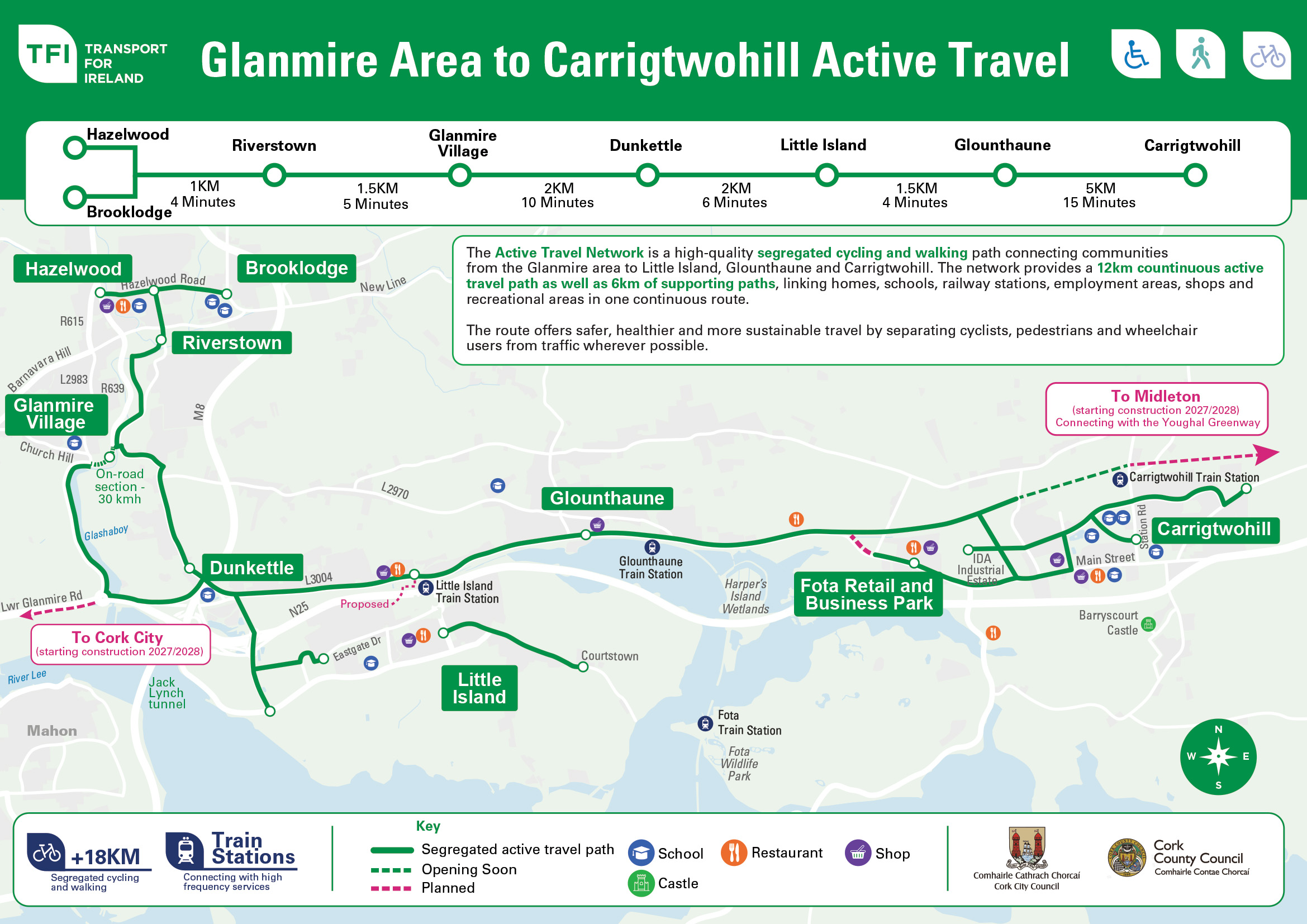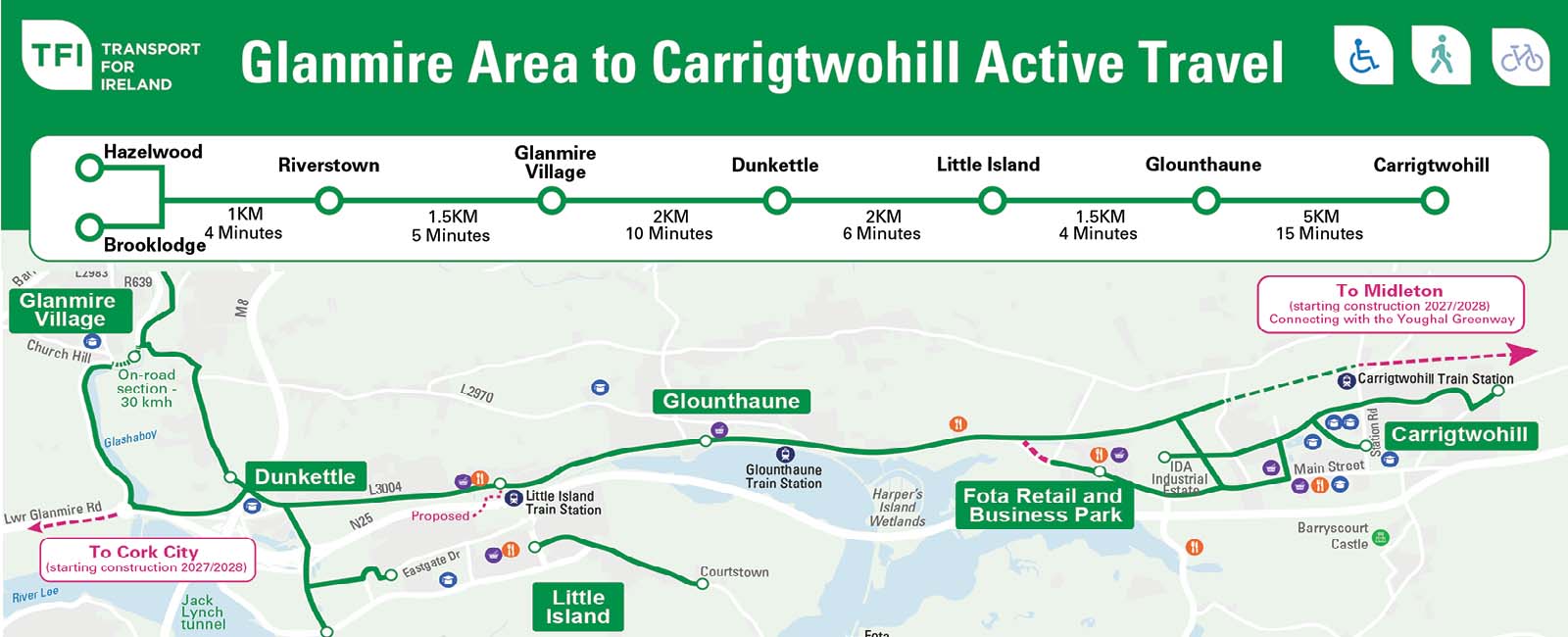
The National Transport Authority (NTA), in partnership with Cork City Council and Cork County Council, has published a new Active Travel map highlighting the growing network of walking and cycling routes connecting the Glanmire area, Little Island, Glounthaune and Carrigtwohill.
A connected network for walking and cycling
The map showcases significant Active Travel improvements delivered in recent years, including high-quality segregated walking and cycling infrastructure that now provides a continuous 12km route, supported by a further 6km of connecting paths.
Improving access to local destinations
These improvements make it easier and safer for people to access homes, schools, rail stations, workplaces, shops and recreational destinations without relying on car travel.
Supporting healthier and more sustainable travel
Delivered by Cork City Council and Cork County Council with funding from the NTA, the schemes are helping to create healthier, more sustainable travel choices for communities across the eastern Cork metropolitan area.